A meteorological monitoring system in a temperate forest in Mexico
DOI:
https://doi.org/10.29298/rmcf.v13i74.1260Keywords:
calibración, estaciones meteorológicas, instalación, relieve, representatividad, unidades cartográficasAbstract
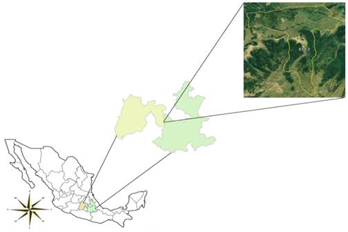
The meteorological variables monitoring is important in the study of plant biophysical processes such as the development and growth, capture and retention of water, increase of nutrients and use of environmental services. The objective of this work was to propose a meteorological monitoring system based on the analysis of the natural environment to provide a representative database. The proposal was developed in Zoquiapan Experimental Forest Station, central Mexico. Methods include the representativeness of the biophysical conditions in a semi-cold temperate forest in central Mexico. First, maps of geoforms, climate and vegetation were generated to delimit the homogeneous cartographic landscape units. Subsequently, by means of location criteria, three cartographic units were selected for the establishment of three meteorological stations. The monitoring system has two Davis Instruments automatic stations and another that operates with an Arduino open-source microcontroller. Data is recovered monthly on a laptop with an USB cable. Before the installation of the stations, the sensors were subjected to a comparison with a reference station. It was showed that the data of the first days of operation revealed differences in the climate between the units concluding that locating the stations on an altitudinal trajectory can contribute to relate the climate with different vegetation and geoforms.
Downloads
References
Adepoju, T. M., M.Oladele, A.Kasali and G.Fabiyi. 2020. Development of a Low-Cost Arduino-Based Weather Station. FUOYE Journal of Engineering and Technology 5(2): 69-73. http://dx.doi.org/10.46792/fuoyejet.v5i2.508 DOI: https://doi.org/10.46792/fuoyejet.v5i2.508
Blanco, S., G. Ceballos, C. Galindo, J. M. Maass, R. Patrón, A. Pescador and I. Suarez A. 1981. Ecología de la estación experimental Zoquiapan: descripción general, vegetación y fauna (1a ed.). México: Serie Agronomía 2, Universidad Autónoma Chapingo. 114 p.
G. Corvino, A. Lessio and E. Borgogno-Mondino, "Monitoring Rice Crops in Piemonte (Italy): Towards an Operational Service Based on Free Satellite Data," IGARSS 2018 - 2018 IEEE International Geoscience and Remote Sensing Symposium, 2018, pp. 9070-9073, doi: 10.1109/IGARSS.2018.8518634. DOI: https://doi.org/10.1109/IGARSS.2018.8518634
DAVIS. 2015. Weather Instruments. Retrieved from: http://www.davisnet.com/weather-monitoring/ (Consulted on october 20, 2019).
Ferdoush, S. and X. Li. 2014. Wireless sensor network system design using raspberry Pi and arduino for environmental monitoring applications. Procedia Computer Science, 34: 103-110. http://doi.org/10.1016/j.procs.2014.07.059 DOI: https://doi.org/10.1016/j.procs.2014.07.059
Faugel, H., and Bobkov, V. (2013). Open source hard- and software : Using arduino boards to keep old hardware running. Fusion Engineering and Design, 88, 1276–1279. http://doi.org/10.1016/j.fusengdes.2012.12.005 DOI: https://doi.org/10.1016/j.fusengdes.2012.12.005
García, E. 2004. Modificaciones al sistema de clasificación climática de Köppen. (5a ed.). México: Instituto de Geografía de la UNAM. Ciudad de México, México. 91 p.
Gómez J., D., D. Etchevers J., I. Monterroso A., C. Gay, J. Campo and M. Martínez. 2008. Spatial estimation of mean temperature and precipitation in areas of scarce meteorological information. Atmósfera, 21(1), 35-56. Retrieved from https://www.revistascca.unam.mx/atm/index.php/atm/article/view/8596
Gómez M., L. and L. Arriaga. 2007. Modeling the effect of climate change on the distribution of oak and pine species of Mexico. Conservation Biology, 21(6), 1545-1555. http://doi.org/10.1111/j.1523-1739.2007.00814.x DOI: https://doi.org/10.1111/j.1523-1739.2007.00814.x
Instituto Mexicano de Tecnología del Agua (IMTA). 2006. Extractor rápido de información climática (ERIC) versión 3. México: Servicio Meteorológico Nacional. Instituto Mexicano de Tecnología del Agua
Instituto Nacional de Ecología (INE). 2010. Manual 4. Operación de estaciones de medición de la calidad del aire, mantenimiento y calibración de sus componentes (1a ed.). México: Instituto Nacional de Ecología. 75p.
Instituto Nacional de Estadística, Geografía e Informática (INEGI). 2016a. Cuerpos de agua. Instituto Nacional de Estadística y Geografía. Retrieved from: http://www.inegi.org.mx/geo/contenidos/recnat/hidrologia/infoescala.aspx (Consulted on july 18, 2016)
Instituto Nacional de Estadística, Geografía e Informática (INEGI). 2016b. Estructuras geológicas. Instituto Nacional de Estadística y Geografía. Retrieved from: http://www.inegi.org.mx/geo/contenidos/recnat/geologia/infoescala.aspx (Consulted on july 18, 2016)
Instituto Nacional de Estadística, Geografía e Informática (INEGI). 2016c. Modelo de elevación digital. Instituto Nacional de Estadística y Geografía. Retrieved from: http://www.inegi.org.mx/geo/contenidos/datosrelieve/continental/Descarga.aspx (Consulted on july 18, 2016)
Instituto Nacional de Estadística, Geografía e Informática (INEGI). 2016d. Uso de suelo y vegetación. Instituto Nacional de Estadística y Geografía Retrieved from: http://www.inegi.org.mx/geo/contenidos/recnat/usosuelo/ (Consulted on august 22, 2016)
International Soil Reference and Information Centre (ISRIC). 2005. Updated global and national soils and terrain digital databases (SOTER). International Soil Reference and Information Centre. https://www.isric.org/sites/default/files/isric_report_2013_04.pdf (Consulted on august 22, 2016)
Juárez, A., C.Gay and Y. Flores. 2005. Impact of the Popocatepetl's volcanic activity on the air quality of Puebla City, México. Atmósfera, 18(1), 57-69. Retrieved from https://www.revistascca.unam.mx/atm/index.php/atm/article/view/8537
Katyal, A., R. Yadav and M. Pandey. 2016. Wireless Arduino Based Weather Station. International Journal of Advanced Research in Computer and Communication Engineering 5(4): 274-276, Retrieved from:https://www.ijarcce.com/upload/2016/april-16/IJARCCE%2070.pdf (Consulted on july 18, 2016).
Li, D. 2014. Assessing the impact of interannual variability of precipitation and potential evaporation on evapotranspiration. Advances in Water Resources, 70, 1-11. http://doi.org/10.1016/j.advwatres.2014.04.012 DOI: https://doi.org/10.1016/j.advwatres.2014.04.012
Lin, Y. and E.Zini. 2008. Free/libre open source software implementation in schools: Evidence from the field and implications for the future. Computer & education, 50, 1092-1102. http://doi.org/10.1016/j.compedu.2006.11.001 DOI: https://doi.org/10.1016/j.compedu.2006.11.001
Lomas-Barrié, C. T., Terrazas-Domínguez, S., & Tchikoué-Maga, H. (2005). Proposal of territorial ecological ordering for the National Park Zoquiapan and annex. Revista Chapingo Serie Ciencias Forestales y del Ambiente, 11(1), 57–71. Retrieved from https://revistas.chapingo.mx/forestales/?section=articles&subsec=issues&numero=31&articulo=431
Martínez del Castillo, E., Serrano Notivoli, R., Novak, K., Longares, L. A., Arrechea, E., Luis Arrillaga, M. D., & Saz-Sánchez, M. Á. (2012). Cuantificación de los gradientes climáticos altitudinales en la vertiente norte del Macizo del Moncayo a partir de una nueva red de estaciones automáticas en altura. Publicaciones de la Asociación Española de Climatología. Serie A; 8. http://hdl.handle.net/20.500.11765/8316
Martínez-Santiago, S., Alvarado-Segura, A., Zamudio-Sánchez, F., & Cristobal-Acevedo, D. (2017). Spatiotemporal analysis of forest modeling in Mexico. Revista Chapingo Serie Ciencias Forestales y del Ambiente, 23(1), 5–22. doi: 10.5154/r.rchscfa.2016.01.003 DOI: https://doi.org/10.5154/r.rchscfa.2016.01.003
Meulenert P., Á. R., H. U. Ramírez-Sánchez, F. O. García-Concepción, M. E. García-Guadalupe y J. Alcalá-Gutiérrez. 2005. Implementación de un sistema de alerta temprana contra fenómenos meteorológicos extremos e incendios forestales del Área Natural Protegida «Bosque de la Primavera» Jalisco, México, como parte de un proyecto de desarrollo y monitoreo sistemático e integral. México: Instituto de Astronomía y Meteorología, Universidad de Guadalajara.
Paredes-González, A., Monterroso-Rivas, A. I., Rodríguez-Esparza, L. J., and Zamudio-Sánchez, F. J. (2018). Projection and probability of land use change in Zoquiapan, Mexico: considerations for forest management. Revista Chapingo Serie Ciencias Forestales y del Ambiente, 24(1), 59-71. doi: 10.5154/r.rchscfa.2017.07.041 DOI: https://doi.org/10.5154/r.rchscfa.2017.07.041
Pompa G., M., F. J. Rodríguez F., C. A. Aguirre S. y L. Miranda A. 2013. Influencia de la evaporación en el crecimiento forestal. Agrociencia, 47(8), 829-836. https://www.agrociencia-colpos.mx/index.php/agrociencia/article/view/1059
Reyes A., G., S. Adame M. y E. Cadena V. 2018. Vulnerabilidad ante la variabilidad climática en los cultivos de maíz Zea mays. Sociedad y Ambiente, 6(17):93-113. ISSN:2007-6576 https://doi.org/10.31840/sya.v0i17.1842 DOI: https://doi.org/10.31840/sya.v0i17.1842
Romo J., R. y R. Arteaga. 1989. Meteorología agrícola. México: Departamento de irrigación, Universidad Autónoma Chapingo.
Sparkfun. 2013. Sparkfun. Retrieved from: https://learn.sparkfun.com/tutorials/weather-shield-hookup-guide (Consulted on october 17, 2016).
Stallman, R. M. 2004. Software libre para una sociedad libre. Madrid, España: Traficantes de sueños. Retrieved from: https://www.gnu.org/philosophy/fsfs/free_software.es.pdf (Consulted on july 18, 2016).
Torres-Quezada, J., Coch, H., and Isalgué, A. (2021). Data set of climatic factors measured in a low latitude region with warm and humid climate: Solar radiation, cloud cover and sky temperature. Data in Brief, 38:107404. https://doi.org/10.1016/J.DIB.2021.107404 DOI: https://doi.org/10.1016/j.dib.2021.107404
World Meteorological Organization (WMO). 2008. Guía de instrumentos y métodos de observación meteorológicos (No. 8). Suiza: World Meteorological Organization. Retrieved from: https://library.wmo.int/doc_num.php?explnum_id=3664 (Consulted on july 18, 2016).
Yang, C. H., and Regan, A. C. (2014). Methodology for the prioritization of environmental sensor station installation (case study of South Korea). Transport Policy, 32, 53–59. http://doi.org/10.1016/j.tranpol.2013.12.012 DOI: https://doi.org/10.1016/j.tranpol.2013.12.012
Published
How to Cite
Issue
Section
License
Copyright (c) 2022 Revista Mexicana de Ciencias Forestales

This work is licensed under a Creative Commons Attribution-NonCommercial 4.0 International License.
The authors who publish in Revista Mexicana de Ciencias Forestales accept the following conditions:
In accordance with copyright laws, Revista Mexicana de Ciencias Forestales recognizes and respects the authors’ moral right and ownership of property rights which will be transferred to the journal for dissemination in open access.
All the texts published by Revista Mexicana de Ciencias Forestales –with no exception– are distributed under a Creative Commons License Attribution-NonCommercial 4.0 International (CC BY-NC 4.0), which allows third parties to use the publication as long as the work’s authorship and its first publication in this journal are mentioned
The author(s) can enter into independent and additional contractual agreements for the nonexclusive distribution of the version of the article published in Revista Mexicana de Ciencias Forestales (for example, include it into an institutional repository or publish it in a book) as long as it is clearly and explicitly indicated that the work was published for the first time in Revista Mexicana de Ciencias Forestales.
For all the above, the authors shall send the form of Letter-transfer of Property Rights for the first publication duly filled in and signed by the author(s). This form must be sent as a PDF file to: ciencia.forestal2@inifap.gob.mx
This work is licensed under a Creative Commons Attribution-Noncommercial 4.0 International license.